
Geolocation QR Code Generator
Create a geolocation QR code. Enter your details, customize size and colors, then download as PNG or SVG for printing and sharing.
Generate Your QR Code
Settings:
Download File Type:
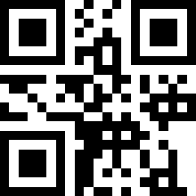
What this tool does
This tool makes a QR code that opens an exact location, set by its coordinates, in a map app. Scan it and a pin drops on the precise spot, ready to navigate to. It is built for places that do not have a street address. Enter the latitude and longitude, set the size and colours, and download a PNG or SVG.
How to use it
- Enter the latitude and longitude of your spot (how to find them is just below).
- Set the size and colours if you want.
- Choose PNG or SVG, create the code, and download it.
How it works
The tool encodes your coordinates as a standard geographic location link in the QR pattern, in your browser. When someone scans it, their phone opens its default map app, whether that is Google Maps, Apple Maps, or another, with a pin on the exact point. Because it uses the universal coordinate format rather than a Google link, it is not tied to any one app. The code is static and works on its own, with nothing uploaded.
Finding your coordinates
If you do not already have them, coordinates are easy to read off Google Maps. On a phone, press and hold the exact spot on the map to drop a pin, and the latitude and longitude appear, usually at the top or bottom; on a computer, right-click the spot and the coordinates show at the top of the menu to copy. They look like 27.9881, 86.9250, two decimal numbers: latitude first, then longitude, with a minus sign meaning south of the equator or west of the prime meridian. Pop those two numbers into the fields above, and the code points exactly there.
When coordinates beat a map link
Coordinates come into their own for any place an address cannot describe. A trailhead or summit, a campsite, a meeting point in the middle of a park, a parking area, a particular corner of a large property or farm, a remote work site, a spot for a delivery where there is no door number, or a "we are setting up right here" point for an outdoor event. In all of these, a precise pin is worth far more than a vague address, and coordinates give you exactly that.
The honest trade-off is that a coordinate pin is just a location, with no name or details attached, unlike a proper map listing. It says "here," and nothing more. So if your spot is actually a listed business or a real address, you are better off with the Google Maps QR Code Generator, which brings the name, hours, and reviews along with the directions. Coordinates are the tool for the unmarked spot; a map link is the tool for the named one.
Questions people ask
How do I find my coordinates?
In Google Maps, press and hold the spot on a phone, or right-click it on a computer, to see the latitude and longitude. Copy those two numbers into the fields here.
Which map app does it open?
Whichever is the default on the person's phone, since it uses the universal coordinate format. That could be Google Maps, Apple Maps, or another, and the pin lands on the same exact point either way.
Should I use coordinates or a map link?
Coordinates for an exact spot with no address, like a trailhead or a point in a park. A Google Maps link for a listed place or real address, since that carries the name and details too.
Is my location uploaded?
No. The code is generated entirely in your browser, so your coordinates stay on your device.

Bibhushan Saakha is a UI/UX developer with experience in design systems, Figma, Adobe Illustrator, and interface focused visual thinking. He had a strong eye for clarity, contrast, layout, and visual usability, and also holds a national record in blindfolded cube solving. At Eon Tools, he reviews color and QR tools.
Other Tools
- Bank Account QR Code Generator
- Bitcoin QR Code Generator
- Bitcoin Wallet Address QR Code Generator
- Business QR Code Generator
- Coupon QR Code Generator
- Dog Tag QR Code Generator
- Email QR Code Generator
- Event QR Code Generator
- Feedback Form QR Code Generator
- Google Drive QR Code Generator
- Google Form QR Code Generator
- Google Maps QR Code Generator
- Google Meet QR Code Generator
- Google Reviews QR Code Generator
- Instagram QR Code Generator
- LinkedIn QR Code Generator
- Marketing QR Code Generator
- MeCard QR Code Generator
- Payment QR Code Generator
- Paypal QR Code Generator
- PDF QR Code Generator
- Pet Tag QR Code
- Phone QR Code Generator
- Pinterest QR Code Generator
- QR Code Decoder
- QR Code Scanner
- QR Code Generator with Logo
- Resume QR Code Generator
- SEPA EPC QR Code Generator
- Skype QR Code Generator
- SMS QR Code Generator
- Text QR Code Generator
- URL QR Code Generator
- vcard QR Code Generator
- Website QR Code Generator
- Whatsapp QR Code Generator
- Wifi QR Code Generator
- Youtube QR Code Generator
- Zoom Meeting Link QR Code Generator